Welcome to the TFC Commodity Trading Forum.
Please feel welcome to join in on these informative ongoing discussions about trading futures and commodities.

The Trading Forum is intended for the open discussion of commodities trading. The management of this Forum does not agree or disagree with the ideas exchanged, and does not exert editorial control over the message posted herein. Read and post at your own risk. The risk of loss in trading or commodities can be substantial. We discourage the use of this Forum to promote trading that is acknowledged to be risky. Please note: many links from the Forum lead to pages on other web sites. We cannot take responsibility for nor endorse the information presented on those sites.

TFC Commodity Trading Forum

Re: NG tropical weather *PIC*
In Response To: NatGas ?? Build est, Wx/Ceejay ()

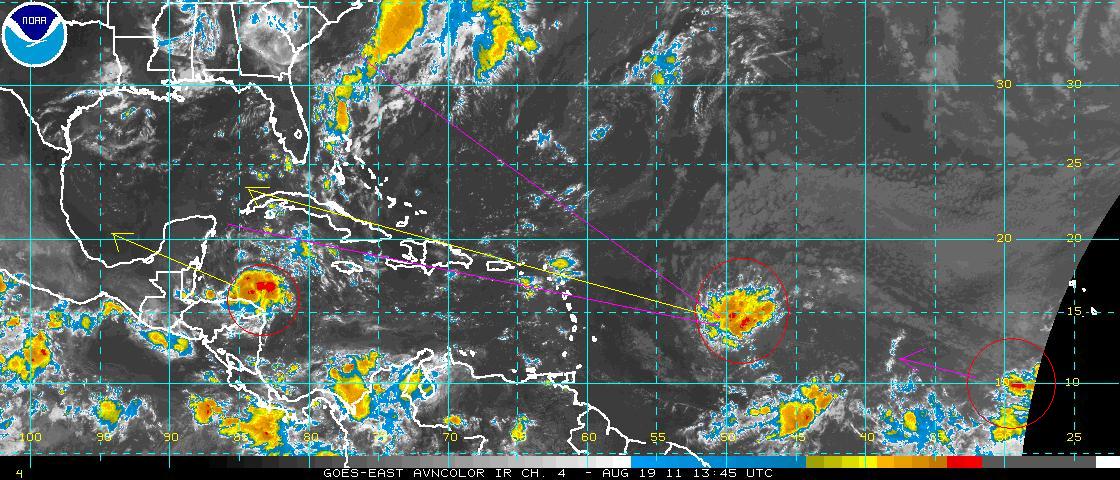
There's a few storms brewing. The red circled storm in the middle of the pic is the one that poses the most risk. The yellow line is the model consensus track; the purple lines represent the range of uncertainty through the next 7 days. All models develop this into a significant hurricane (cat2-4); the big question is exactly where does it go. My feeling is that it will indeed be a gulf of mexico storm. A betting man would be tempted by NG and Oil futures today.