Welcome to the TFC Commodity Trading Forum.
Please feel welcome to join in on these informative ongoing discussions about trading futures and commodities.

The Trading Forum is intended for the open discussion of commodities trading. The management of this Forum does not agree or disagree with the ideas exchanged, and does not exert editorial control over the message posted herein. Read and post at your own risk. The risk of loss in trading or commodities can be substantial. We discourage the use of this Forum to promote trading that is acknowledged to be risky. Please note: many links from the Forum lead to pages on other web sites. We cannot take responsibility for nor endorse the information presented on those sites.

TFC Commodity Trading Forum

tropical update *PIC*

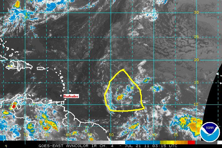
The tropical wave in question is about 800 mi due east of Barbados moving just slightly north of west at about 20 mi/hr. Although it is well organized at elevation, currently only a small area of thunderstorms have developed. Most of the main computer models generally show a weak trough of low pressure entering the eastern Caribbean Friday afternoon and do not indicate further strengthening; save one - the Canadian model, which brings a tropical storm into the Bahamas on Monday. This model tends to develop storms too quickly, which causes them to move too far to the north. So I would discount its solution. Nevertheless there is still lots of potential with this disturbance and i'll continue to post when and if the situation changes significantly.