A small retreat of the heat over most of the east is in store Aug 7-14 as the strong ridge responsible pulls back a little into the southern plains and gulf coast states. New England should see temps near normal with above to well above normal confined to a regon south of a line drawn from Philadelphia west to west-central OK and south to west Texas. Cool over the Pac NW and near normal elsewhere.
This week should see 90+ daytime highs south of a line from NYC west to the rockies (and of course over the desert SW) with an extension of very warm conditions into the northern plains and Montana/Wyoming east of the mountains. The NE will cool off by the end of the week to near normal temperatures.
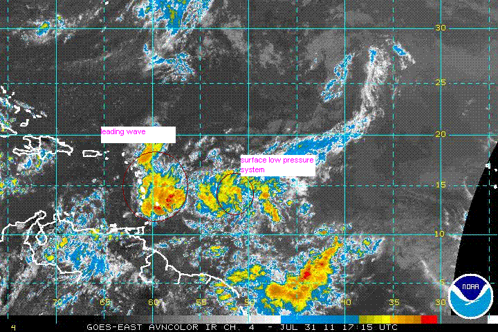
The tropics are starting to become quite active. The Hurricane center is keeping tabs on a tropical depression well west of the windward islands. Meawhile, a tropical wave has started to intensify directly over the Windwards. So far, comouter models are suggesting that only 1 tropical storm will emerge from these 2 regions, but I am not convinced of that. I'll keep tabs through the week, especially if the leading disturbance shows signs of development , as it would be the more likely of the two to enter the Gulf of mexico.
.