The area of higher to much higher than average temperatures will retreat to Texas, the gulf coast states and the desert SW. The rest of the country will be near normal except slightly cooler than average over South Dakota.
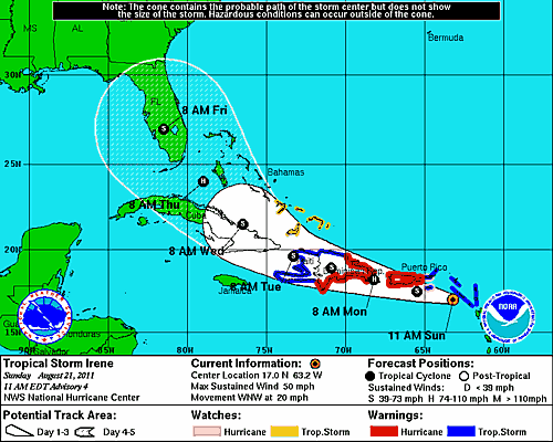
This week will see the approach of Tropical storm, soon Hurricane, Irene. The broad model consensus it that its heading smack for south Florida. I say broad because there is still considerable uncertainty in the track forecast. Some models move it west of the penninsula into the western gulf of Mexico; others offshore to the east of the State. Regardless of the track, it is likely to be a formidiable hurricane by the time it gets near the US; I think somewhere between category 2 -4. Here is the official National Hurricane center forecast. The white lines represent a 90% confidence level for position through time. As you can see, even 5 days out, a gulf storm remains a possibility.