For the week of October 3-10 ensemble models suggest above average temperatures generally in the west except CA where it will be near-normal; quite cooler than normal in the SE and near normal to slightly below normal elsewhere. In aggregate, I expect average national temperatures and NG demand near seasonally average values.
This week a stalled frontal boundary along the east coast will bring muggy conditions, heavy thundershowers and a risk of local flooding along the east coast from FL to New York. As the frontal zone moves gradually east, the NE will cool off significantly toward the end of the week.
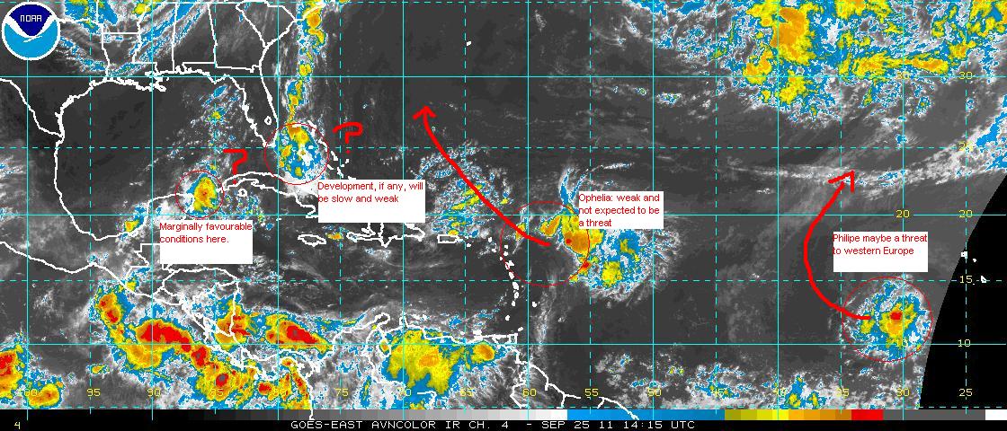
In the tropics, neither of the 2 currently active storms, Ophelia and Philippe, pose a risk to the US mainland. In fact Philippe is expected to turn in the general direction of western Europe later in the week where, given his name, he probably belongs. At the tail end of the east coast frontal boundary there is an area of interest just east of Florida. Some models develop a tropical depression/storm out of this during the week but if one does it is likely to remain offshore. The SE gulf of mexico and the Caribbean will become increasingly receptive to tropical storm development during the next 2 weeks but so far no distinct storm is showing up in the models. We do see a little disturbance off the Yucatan this morning but nothing yet suggests this particular cluster of storms has a future.