The last full week of July brings a shift from hot in the NE to cool as a pattern of western ridge and eastern trough is re-established. In fact the only areas that remain above average temperature-wise are the Great Basin and inland California. The period promises to be quite wet in the east, from the Plains to the Atlantic seaboard, and especially over the SE with a focus on Georgia and the Carolinas.
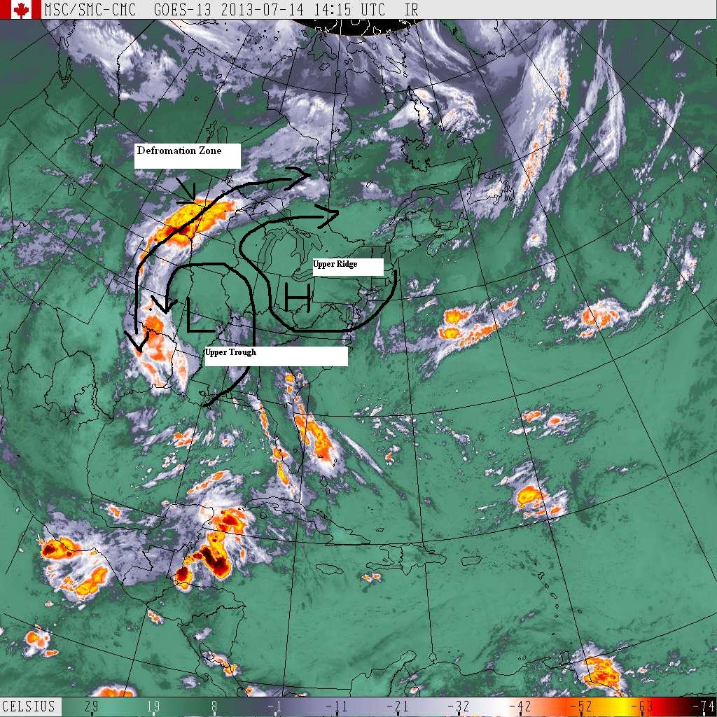
This week starts with a very strong ridge of high pressure over the Ohio Valley and a retrograding (moving E to W rather than the usual W to E) upper trough over Arkansas. Northwest of the upper trough and west of the ridge there's an area in the upper atmosphere called a "deformation zone" that's helping develop large thunderstorms over South Dakota this morning. Deformation zones act to concentrate moisture. On Monday this zone will produce thunderstorms in an arc from northern New Mexico to NW Minnesota, shifting west into Arizona and southern Utah by Tuesday. It will weaken as it moves into southern Nevada and extreme SE California by Wednesday.
To the east of the upper trough, strong thunderstorms can be expected daily as it moves, by Friday, to Southern Arizona. Its drawing moisture to the N from the Gulf of Mexico and increasing instability in its wake. West Texas is primed for considerable rainfall from this system this week and it needs it badly.
The upper ridge will gradually weaken and only slowly shift to the west during the week. Hot and muggy conditions will be especially noted over the Oho Valley during the period. The SE return flow at the bottom of the ridge will draw in air from the Atlantic resulting in frequent thunderstorm to the SE during the week; especially over Florida.
By Friday a cool front is bringing strong thunderstorms from the upper Midwest thru the Great lakes that will extend into New England through the weekend.