Generally, into the second week of August, only the Pacific NW (inland from the immediate Pacific coastline) and most of Texas can expect warmer than average temperatures. It will be colder than averages over most of the Northeast, Ohio Valley, Midwest and Plains and near average elsewhere. Fairly damp in the East with daily high chances of precipitation in the form of showers and thunderstorms although Texas should be dry relative to the rest of the lower 48 east of the Rockies.
This week most of the monsoon wetness will be out of the desert SW. A path of frequent showers and thundershowers will set up along a fairly stable jet stream running from the northern plains, dipping south toward the Mason-Dixon line then arcing back toward the NE. Early in the week models suggest a few strong storms will move out of the Colorado Rockies and dump significant rain on Kansas.
The overall pattern starts off the week with a strong trough over the east, weak ridging over New Mexico and basically west-to-east flow elsewhere. Although the trough over the east (centered over Lake Michigan this morning) will lift out to the NE and to Northeast Quebec by mid-week, another will slide down from the Canadian Prairies to maintain a general trough over the East (although quite a bit weaker than today's). Meanwhile, over the West, the ridge over new Mexico will build through mid-week, only to weaken toward the weekend as a small upper trough that develops over the Pacific off the Washington coast early in the week finally moves SW and into Oregon by Friday.
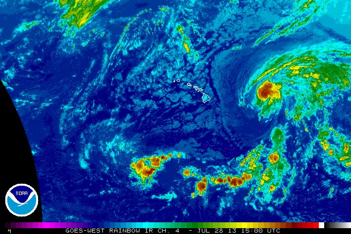
A tropical disturbance that is the remains of Tropical Storm Dorian is several hundred miles NE of the Leeward Islands this morning. Its not expected to develop by the National Hurricane Center but looking at its satellite images this morning makes me think it could very well re-develop and will need watching. Its outflow at very high elevations seems to be re-developing and that is a prerequisite for this type of storm's intensification. If it does re-develop, South Florida and the Bahamas will be on the hit list after the middle of the week. Over the eastern Pacific, tropical storm Flossie should bring a rare bit of wind and good rainfalls to much of Hawaii later today and tomorrow. Hawaii is in a serious drought and although there is a risk of mudslides from Flossie, the rain should generally be very welcome.
Flossie approaching Hawaii this morning.